
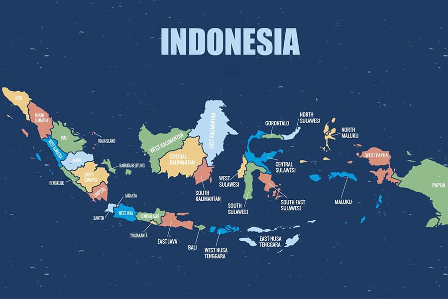
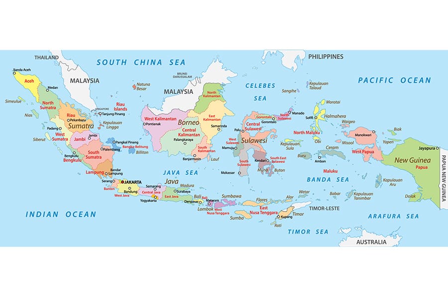
Indonesia, the world’s largest archipelago, is a vibrant nation sprawling across thousands of islands in Southeast Asia. The Indonesia map reveals a stunning tapestry of diverse landscapes, cultures, and ecosystems, from bustling urban centers to remote volcanic islands. Whether you’re planning a trip, looking into Indonesia tours, or simply curious about the map of Indonesia, this article delves into the geographical highlights of the country, broken down into its western, eastern, northern, and southern regions, along with a guide to navigating the Indonesia travel map.
Western Indonesia on Map
The western part of the Indonesia map is dominated by the large island of Sumatra and the western half of Java, two of the country’s most significant regions. Sumatra, located on the northwestern edge of the archipelago, is a land of contrasts. Its lush rainforests, such as those in Gunung Leuser National Park, are home to endangered species like orangutans, while cities like Medan and Palembang pulse with urban energy. The map of Indonesia highlights Sumatra’s proximity to Malaysia and Singapore, making it a gateway for international travelers.
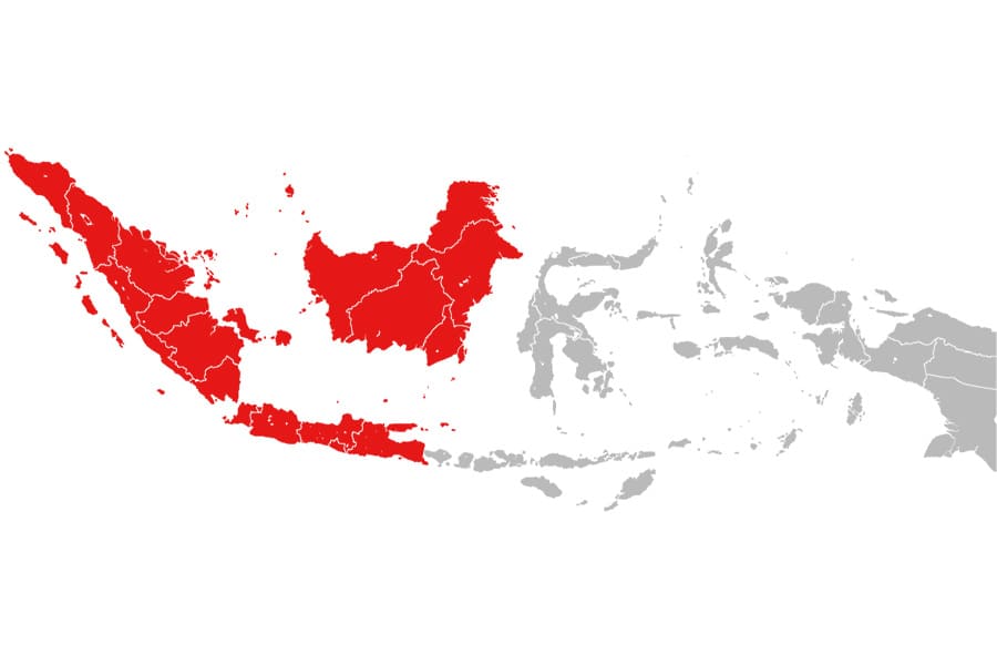
Java, Indonesia’s political and economic heart, occupies a central place in the western Indonesia on map. Jakarta, the bustling capital, is a melting pot of cultures, with towering skyscrapers and historic sites like Kota Tua. Further west, Bandung’s cooler climate and tea plantations draw visitors seeking respite from the tropical heat. The western region also includes smaller islands like Bangka Belitung, known for their pristine beaches and tin mining history. Navigating the western Indonesia map reveals a blend of urban sophistication and natural wonders, from volcanic peaks like Mount Krakatoa to the serene beaches of Bintan.
Eastern Indonesia Map
Moving to the eastern side of the Indonesia map, you’ll encounter a region defined by its remote beauty and cultural richness. Eastern Indonesia includes the islands of Bali, Lombok, Flores, and the vast Maluku and Papua provinces. Bali, a global tourism hotspot, is a standout on the map of Indonesia. Its iconic rice terraces, vibrant Hindu temples, and surf-friendly beaches make it a must-visit. Nearby Lombok offers a quieter alternative, with Mount Rinjani’s challenging treks and the idyllic Gili Islands.
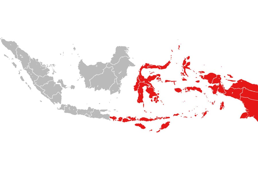
Further east, the Indonesia on map showcases the rugged landscapes of Flores, a gateway to Komodo National Park, home to the famous Komodo dragons. The Maluku Islands, often called the Spice Islands, are steeped in colonial history and dotted with coral reefs perfect for diving. Papua, occupying the western half of New Guinea, is one of the most biodiverse regions on Earth, with dense jungles and indigenous cultures that remain largely untouched by modernity. The eastern Indonesia map is a treasure trove for adventurers seeking off-the-beaten-path experiences, from diving in Raja Ampat to exploring ancient traditions in Tana Toraja.
Northern Indonesia Map
The northern part of the Indonesia map encompasses regions like Aceh, North Sumatra, and the northern coasts of Sulawesi and Kalimantan. Aceh, at the northwestern tip of Sumatra, is known for its strict adherence to Islamic traditions and its resilience in the face of natural challenges, such as the 2004 tsunami. The map of Indonesia highlights Banda Aceh as a cultural hub with historical mosques and vibrant markets.
North Sulawesi, another gem on the northern Indonesia on map, is a paradise for divers. The Bunaken Marine Park, with its world-class coral reefs, attracts marine enthusiasts from across the globe. Manado, the region’s main city, serves as a base for exploring nearby volcanic landscapes and pristine islands. Kalimantan’s northern coast, part of Indonesian Borneo, offers a glimpse into the island’s wild interior, where Dayak communities and orangutan sanctuaries thrive. The northern Indonesia map is a blend of cultural heritage and natural splendor, making it ideal for travelers seeking both adventure and cultural immersion.
Southern Indonesia Map
The southern regions of the Indonesia map include southern Java, Bali’s southern coast, and the Lesser Sunda Islands, such as Sumba and Timor. Southern Java is home to Yogyakarta, a cultural hub famous for its ancient temples, Borobudur and Prambanan, both UNESCO World Heritage Sites. The map of Indonesia also highlights Bromo Tengger Semeru National Park, where the otherworldly Mount Bromo draws photographers and hikers alike.
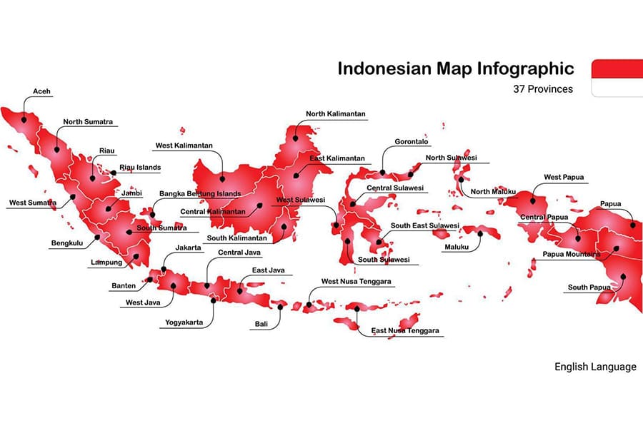
Bali’s southern coast, including areas like Kuta, Seminyak, and Nusa Dua, is a magnet for beach lovers and luxury travelers. The Indonesia on map shows these areas as vibrant tourism hubs with world-class resorts and nightlife. Further south, islands like Sumba offer a stark contrast with their rugged landscapes and traditional villages, where ancient megalithic tombs and unique weaving traditions persist. Timor, shared with East Timor, is another highlight of the southern Indonesia map, offering a mix of colonial history and unspoiled beaches. This region is perfect for those seeking a balance of cultural exploration and coastal relaxation.
Indonesia Travel Map
For travelers, the Indonesia travel map is an essential tool for navigating this sprawling archipelago. With over 17,000 islands, planning a trip requires a clear understanding of the map of Indonesia and its key destinations. The Indonesia travel map typically highlights major hubs like Jakarta, Bali, and Surabaya, which serve as entry points for international flights. From these hubs, travelers can access domestic flights, ferries, or buses to reach smaller islands and remote regions.
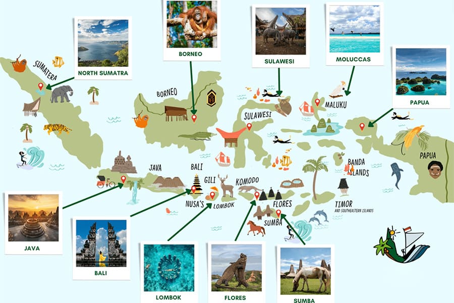
When using the Indonesia on map for travel planning, prioritize regions based on your interests. For cultural experiences, Java’s Yogyakarta and Bali’s Ubud are unmissable. For nature and wildlife, Sumatra’s rainforests and Papua’s Raja Ampat offer unparalleled biodiversity. Beach lovers will find paradise in Bali, Lombok, or the Gili Islands, while adventure seekers can explore volcanic treks in Flores or diving spots in Sulawesi. The Indonesia travel map also helps identify practical details, such as ferry routes between islands or the best seasons to visit (the dry season, May to September, is ideal for most regions).
To make the most of your journey, consider digital tools like interactive Indonesia map apps or GPS-enabled guides, which provide real-time navigation and highlight hidden gems. Whether you’re island-hopping or focusing on a single region, the map of Indonesia is your gateway to discovering the archipelago’s endless wonders.